Autonomous river exploration and mapping system
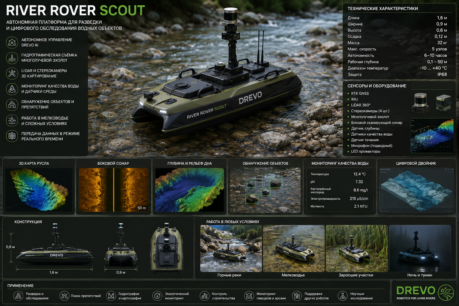
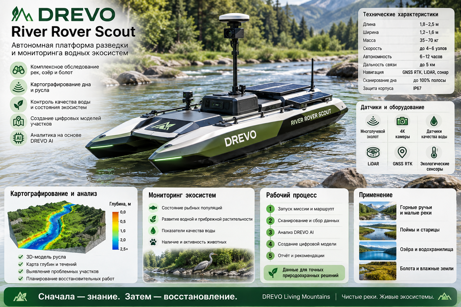
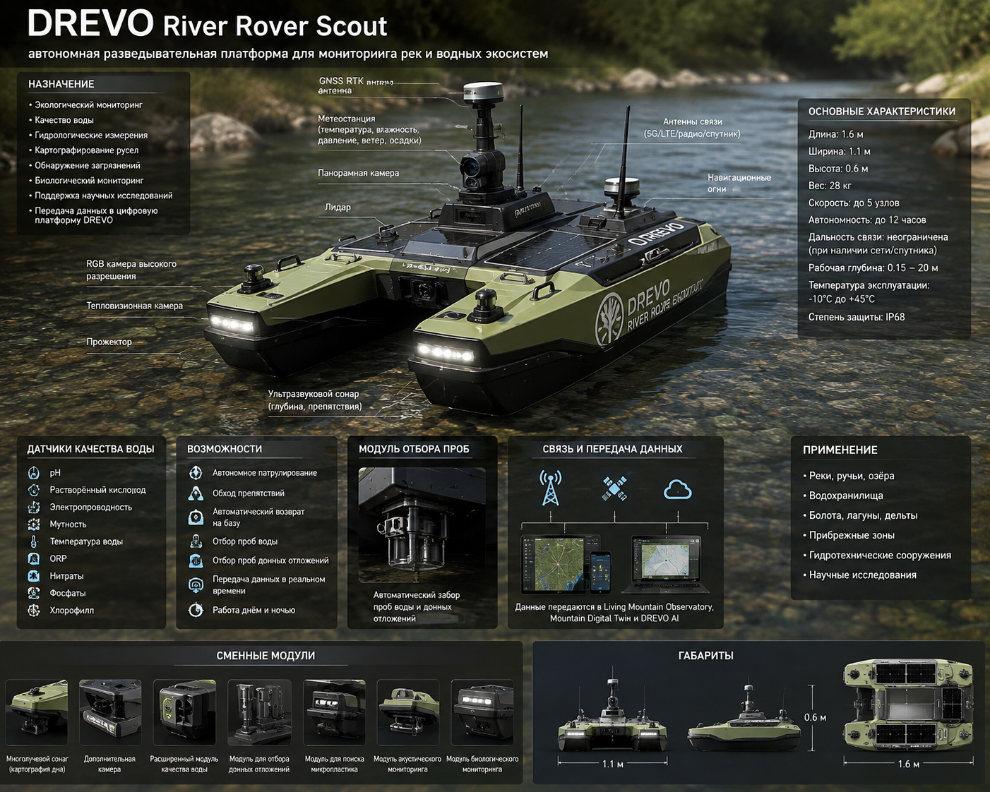
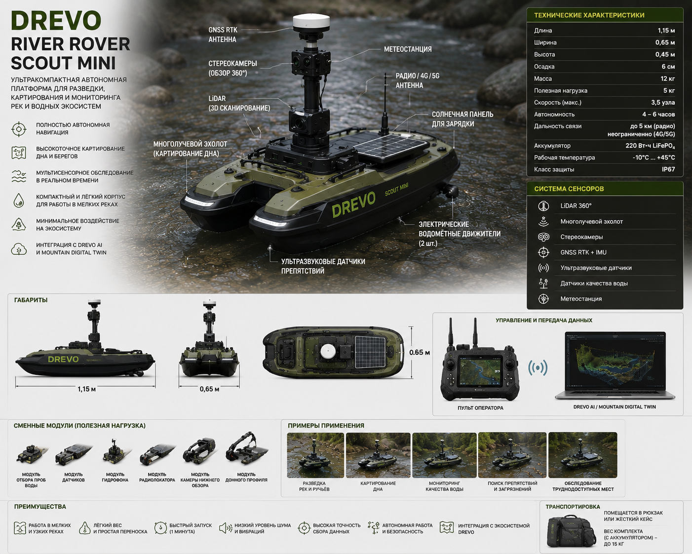
DREVO River Rover Scout— a specialized robotic platform for surveying rivers, streams, lakes, and reservoirs. This is the first stage of any restoration program.DREVO Living Mountains, which ensures the creation of a highly accurate digital model of the reservoir before cleaning or restoration begins.
The main task of Scout isunderstand the river, rather than changing it.
"First study, then restore."
Main tasks
Channel mapping.
Creating a 3D model of the bottom.
Search for springs.
Search for rubble.
Search for bog wood.
Search for spawning grounds.
Search for contamination.
Flow analysis.
Coastal erosion control.
Biodiversity monitoring.
Main areas of examination
Bathymetry Mapping
Construction of a depth map.
Measured:
depth;
channel profile;
pits;
rifts;
thresholds;
underwater channels.
River Bottom Scan
Creation of a digital model of the bottom.
The following are determined:
stones;
boulders;
sand;
open;
clay;
gravel;
wood;
metal;
garbage.
Spring Detection
Search:
underwater springs;
filtration outlets;
groundwater discharge sites.
Used:
temperature analysis;
electrical conductivity;
acoustic data;
hydrological modeling.
Timber Detection
Search:
sunken logs;
bog wood;
tree debris.
For each object the following are recorded:
coordinates;
dimensions;
depth;
supposed breed;
state.
Habitat Mapping
The following are mapped:
spawning grounds;
gravel areas;
aquatic vegetation;
driftwood;
fish wintering grounds;
shelters.
Pollution Mapping
The following are determined:
plastic;
metal;
construction waste;
petroleum products;
siltation zones;
potential sources of pollution.
Scientific modules
Hydro Module
Measures:
flow speed;
flow direction;
water consumption;
turbulence;
depth.
Water Quality Module
Controls:
temperature;
pH;
electrical conductivity;
dissolved oxygen;
turbidity;
oxidation-reduction potential;
nitrate;
phosphate.
If necessary, specialized sensors for chlorophyll, blue-green algae and other indicators can be added.
Sediment Module
Defines:
silt thickness;
granulometric composition;
sediment accumulation;
possible erosion zones.
Biology Module
Fixes:
fish;
aquatic vegetation;
bivalve mollusks;
crayfish;
amphibians;
traces of animal activity.
Navigation system
Used:
RTK GNSS;
inertial navigation;
LiDAR (surface);
multi-beam or single-beam echo sounder (depending on the model);
side-scan sonar;
stereo cameras;
underwater cameras.
WOOD AI
Artificial intelligence automatically recognizes:
bottom type;
wood;
metal;
plastic;
driftwood;
spawning grounds;
plants;
erosion areas;
potentially dangerous obstacles.
Mountain Digital Twin
After the examination, a digital twin is automatically created.
It includes:
3D model;
depths;
channel profile;
water quality;
photographs;
change history;
development forecast.
Living Mountain Observatory
All results are transferred to:
hydrological center;
monitoring system;
long-term database.
Works in conjunction with other platforms
| Platform | Purpose |
|---|---|
| TREVO AeroSense Drone | Aerial survey and coastal modeling |
| River Rover Clean | Cleaning after examination |
| River Rover Restore | Restoration of the riverbed and spawning grounds |
| River Cargo Platform | Removal of materials |
| Living Mountain Observatory | Continuous monitoring |
| Mountain Digital Twin | Data storage and analysis |
| WOOD AI | Decision support |
Main operating modes
Scout Survey
Complete survey of the river.
Spring Search
Search for springs.
Habitat Survey
Ecosystem mapping.
Timber Survey
Search for bog wood.
Pollution Survey
Pollution map.
Flood Assessment
Post-flood assessment.
Drought Assessment
Analysis of the consequences of drought.
Stages of work
Route planning.
Autonomous passage along the riverbed.
Surface and bottom scanning.
Water quality analysis.
Identification of key environmental objects.
Construction of a digital model.
Forming recommendations for River Rover Clean and River Rover Restore.
Expected results
digital river map;
accurate understanding of the state of the riverbed;
identifying hidden problems;
prioritizing cleaning;
preservation of valuable natural sites;
increasing the efficiency of restoration work;
creation of a database for long-term monitoring.
The main principle
Every recovery begins with an accurate diagnosis.
In the ecosystemDREVO Living MountainsRiver Rover Scout performs the rolethe river's "eyes and ears"It collects data on hydrology, geomorphology, water quality, and habitat conditions, enabling subsequent robotic systems to operate with maximum precision and minimal impact on the natural environment.